


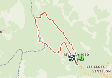
Le Gros têt ou Cime du Rochat (16 km - D. 962 m)

Thomasdanielle
User

Length
16.2 km

Max alt
2608 m

Uphill gradient
964 m
Km-Effort
29 km

Min alt
1737 m

Downhill gradient
963 m
Boucle
Yes
Creation date :
2019-06-12 13:35:41.025
Updated on :
2022-06-11 13:30:18.658
5h51
Difficulty : Very difficult

FREE GPS app for hiking
 SityTrail
IGN / Geographical institutes
SityTrail Plus
The world is yours!
About
Trail Walking of 16.2 km to be discovered at Provence-Alpes-Côte d'Azur, Hautes-Alpes, La Grave. This trail is proposed by Thomasdanielle.
Description
A/D : Chalet parking des remontées mécaniques
départ : prendre la direction des rivets et suivre le torrent.
Attention : pas de sentier marqué après la Brèche ???
Positioning
Country:
France
Region :
Provence-Alpes-Côte d'Azur
Department/Province :
Hautes-Alpes
Municipality :
La Grave
Location:
Unknown
Start:(Dec)
Start:(UTM)
285845 ; 4992869 (32T) N.
Comments